** DONATE TO THE STORM VICTIMS: ARKANSAS DREAM CENTER **
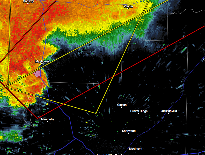
This is what the tornado that crossed over I-40 looked like shortly before 7:30pm CST. I’d like to be able to pinpoint on this screengrab exactly where we were located but unfortunately this isn’t my screengrab, we didn’t have the presence of mind to grab any images once we realized we had came into the storm “too hot”. If you look at the red polygon below you will be able to identify the tornado warned area, the yellow polygons signify thunderstorm warnings. If you were to put your finger on the dot that says Conway in the upper left hand corner of the image below and slide down a quarter of an inch from that, that’s where my wife and 2 year old son were hunkered down in our safe-room. This was why adrenaline was high and we were in such a hurry to return to Conway once we heard the other spotters describing the storm as it formed over Maumelle.
If you haven’t seen our chase video, click here…

Obviously, once the storm crossed over the interstate we lost track of it due to the damage we all sustained, but as many of you are already aware, it tracked itself onto Vilonia and wreaked havoc there as well. The preliminary rating for the tornado was an EF3, but many people in the community think that it will be upgraded by the NWS to an EF4 after they get closer to Vilonia w/ their surveying.
Leave a Reply
You must be logged in to post a comment.